HAKALAU OUR HOME
  • Home
    • Upcoming Events
    • About hakalauhome
    • Contact Us!
  • Yesterday
    • Timeline
    • Camps
    • People >
      • The Ross Families of Hakalau
      • Satoru Kurisu
      • Toraichi Morikawa
      • Waichi Ouye
      • Aigoro Uyeno
    • Schools >
      • Hakalau School
      • John M. Ross School
    • Churches & Cemeteries >
      • Churches >
        • Hakalau Jodo Mission
        • Honohina Hongwanji
      • Cemeteries >
        • Honohina Cemetery
    • The Voice of Hakalau
    • Sugar Production >
      • Hakalau Mill & Other Buildings
      • Wailea Milling Company
    • Infrastructure and Transportation >
      • 19th Century Hamakua Roads
      • Bridges
      • The Railroad
  • Today
    • Hakalau Farmers Market
    • Hakalau Jodo Mission Today >
      • Newsletters
      • Obon Festival
      • Memorial Day
      • Celebrations at Hakalau Jodo Mission
    • Honohina Hongwanji Today
    • Hakalau Reunions
    • Wailea Village Historic Preservation Community >
      • Cemetery Stewardship
      • Reviving Hakalau School
      • Senior Luncheons
      • Mochi Pounding
  • Tomorrow
    • Arsenic Remediation
    • Cliff Failures
    • Hāmākua CDP & the CDP Action Committee

Camps

Picture
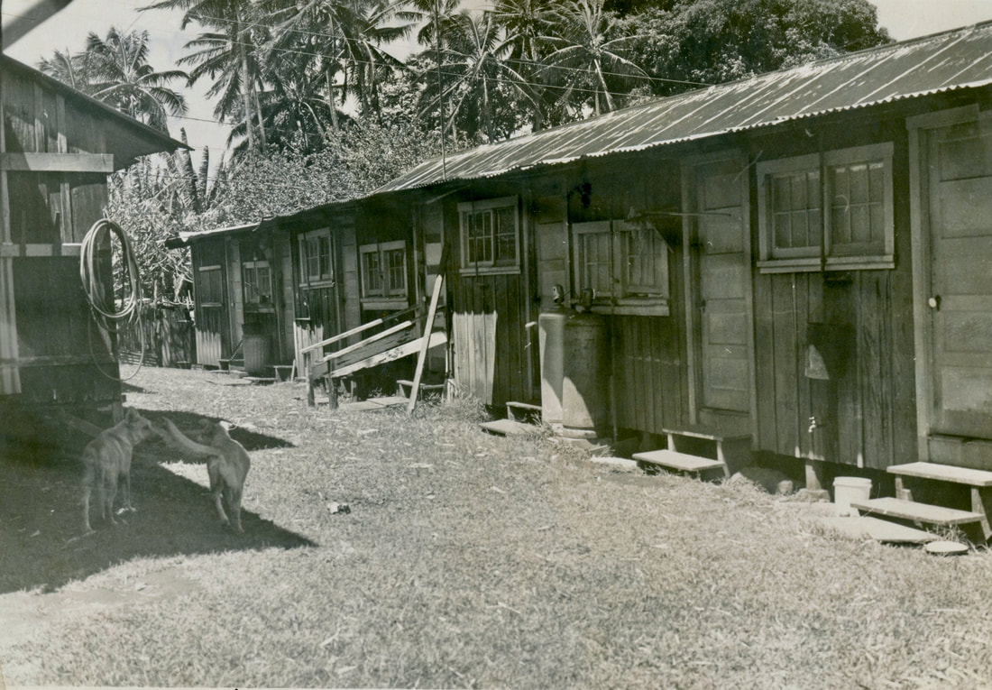
Photo from the Waichi Ouye Collection, courtesy of his family. Presumably from the Hakalau Plantation prior to creation of the 1947 Camp Maps.

Change Over Time in the Camps of the Hakalau Plantation

Plantation camps were the center of social life on the Hakalau Plantation. These camps, needed to house the workforce of immigrants labor Europe, Asia, and the Philippines, were established to support existing practices in cultivation, harvesting, and milling of cane cane. Practices changed over time, impacting:
  • the size of the labor force
  • the number and location of camps
  • the ethnic composition of camps
With Hakalau Plantation's consolidation into Pepeekeo Sugar Company in 1963, the objective of centralizing the workforce houses in Pepeekeo began.  By the 1980s, the camps of Hakalau, once so active, were gone.  In 1994, with the last harvest, most of the remaining workers were living in Pepeekeo, either as renters or owners.    

Camp Locations

Camps were numerous (total of 17 in the early 1950s) and spread out for several miles throughout the plantation’s cane land at elevations from near sea level to 1,200 feet. Apparent reasons for this: 
  • They were created in a time when a large workforce was needed in the fields and the means of transportation between home and the cane fields was limited.  
  • They were created in a time when the plantation often separated housing into ethnic-specific groups. 
  • At least in the case of the Wailea camps, this was a separate plantation until acquired by Hakalau in 1944.  
Initially, a large workforce was required to cultivate and harvest the cane.
Picture
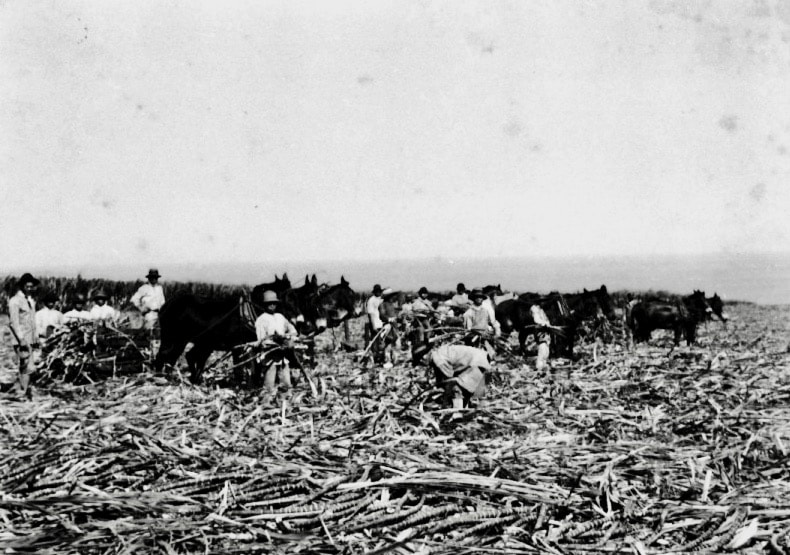
Initially, harvesting was labor-intensive and workers lived near the fields where they worked. Year unknown but believed to be the early 1900s. Photo from the John M. Ross Collection, courtesy of the Lyman Museum.
Mechanization made it possible to cultivate and harvest cane with a smaller workforce.
Picture
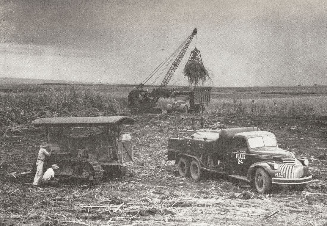
Truck Harvesting at the Hakalau Plantation in 1945 required fewer workers. From the 1945 Annual Report, courtesy of the Edmund Olson Trust Archive.
​In the map below, the location of camps is noted on the Hakalau Plantation Field Map from 1954.

HAKALAU PLANTATION* ANNOTATED FIELD MAP SHOWING CAMPS IN THE 1950s

Picture
Sources: Hakalau Plantation Company Field Map from 1954, annotated using the hand-drawn camp maps from 1947 which show adjacency to specific fields. The Field Map was provided courtesy of the Edmund Olson Trust Archive. *Hakalau Plantation extended from the Kolekole Gulch near Wailea to the Poupou Stream in Ninole.
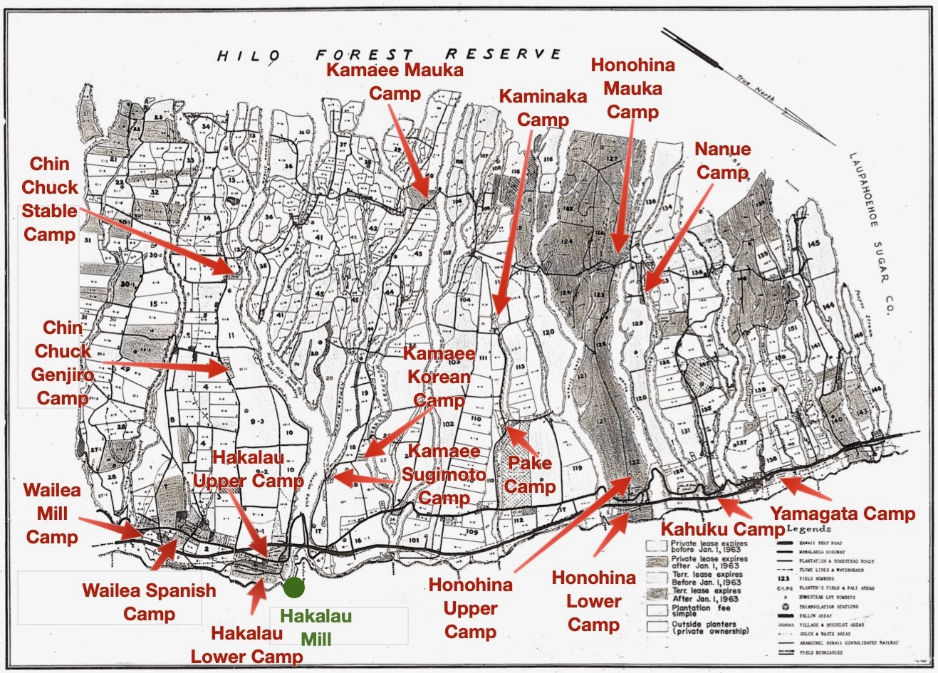
field_map-camps_identified_1950s.jpeg
File Size: 547 kb
File Type: jpeg
Download File

The Domestic Water Map of 1944 (not provided here because it's very hard to read) lists additional camps that no longer existed in the 1950s: Gulch Camp, Porto Rican Camp, Tara House Camp, Uma Uma Mauka Camp. There may have been other camps that were abandoned prior to 1944.
​Pictures of the camp buildings in existence in the early 1950s, copied from insurance valuation forms, are displayed on the separate pages for each of the camps. The photos of buildings from the Hakalau Plantation provided courtesy of the Hawaii Sugar Planters Association Archives at the University of Hawaiʻi-Mānoa - Hawaiian Collection within the Hilo Coast Processing Co. series.
Camp 1 – Hakalau Upper Camp
Camp 2 – Hakalau Lower Camp
Camp 3 – Wailea Spanish Camp
Camp 4 – Wailea Store Camp/Wailea Mill Camp
Camp 5 – Chin Chuck Genjiro Camp
Camp 6 –Chin Chuck Stable Camp
The Kamaee Camps, located in Umauma, included:
Camp 7 – Kamaee Sugimoto Camp
Camp 8: Kamaee Korean Camp
Camp 9: Kamaee Mauka Camp
​​Camp 10: When the camp maps were drawn in 1947, there was NO Camp #10. It may have been Hakalau Gulch Camp, destroyed in the 1946 tsunami.
Camp 11: Honohina Upper Camp
Camp 12: Honohina Lower Camp
Camp 13: Honohina Mauka AND Camp #14: Nanue Camp
Camp 15: Pake (Ah Sing) Camp and Camp 16: Kaminaka Camp
Camp 17: Kahuku Camp
Camp 18: Yamagata Camp
Picture
Hakalau Gulch Camp sometime between 1907 when the covered bridge was either replaced or refurbished and 1930 when the current concrete bridge was built. This camp, believed to have been Camp 10, ceased to exist with the April 1, 1946 tsunami. Photo courtesy of Steve Sutter.
Picture
Voice of Hakalau, August 1947

Initially, Camps were Ethnic-Specific

There was a time when these camps were often ethnic-specific. In Pau Hana: Plantation Life and Labor in Hawaii, author Ronald Takaki notes: 
While the organization of camps into different nationalities may not have sprung from a consciously designed planter policy of residential segregation, it did support the planters' strategy of dividing and thus controlling their work force. Assigned to separate camps, workers of different nationalities were urged to compete against each other not only in the fields but also in the camps. (Takaki, page 93)
Eventually, the camps were multi-ethnic. The history of the Hakalau Jodo Mission provides some insight into the blending the ethnicities in the camps.  Initially, the population around the Mission was almost entirely Japanese and community gatherings were geared towards Japanese culture and Japanese Pure Land Buddhism. Over time, especially during the time of Rev. Mamiya and after World War II, the population became more diverse and the community gatherings increased and expanded to meet community needs. A July 1947 Voice of Hakalau articles states:​
It is the aim and desire of those connected with the Mission that this building and its facilities be available to all interested to use, irrespective of race, color, or creed. As a result, up to the present day, convenient use of same has been made by all. We intend to continue offering its facilities for the ultimate good of the community. ​Comments of T. Morikawa, Chairman of the Fund Drive 
Picture
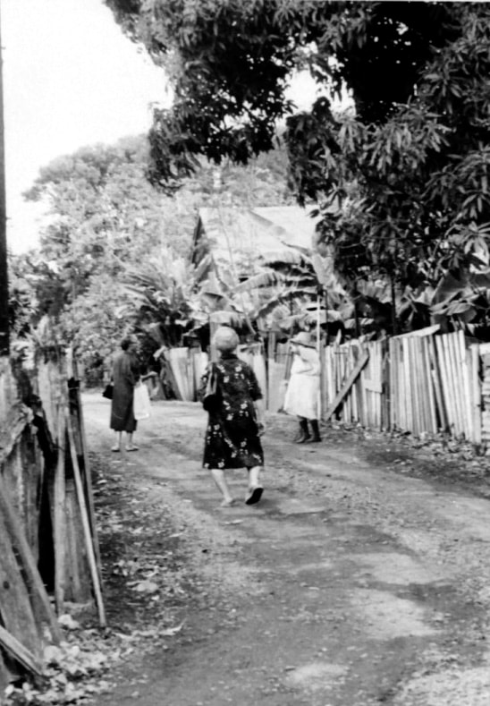
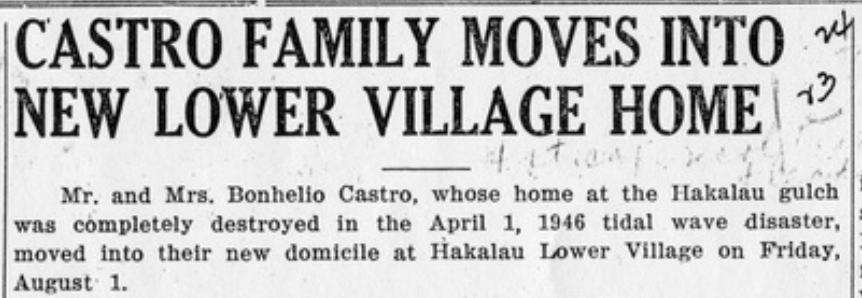
Photo from the John M. Ross Collection, courtesy of the Lyman Museum. Specific camp and year unknown.
Picture
Celebrating Boys Day, a Japanese custom, at one of the Hakalau Camps (perhaps Hakalau Lower Camp). The car to the right dates back to the 1920s. Photo from the Waichi Ouye Collection, courtesy of his family.
By the early 1960s camps were no longer ethnic-specific. While residents were predominantly of Japanese ethnicity because they were the largest group, generally there was also mix of Filipinos, Portuguese and others. ​

Camp Structure, the Quality of Housing, and the Impact of Workforce Reduction

Camp Structure
In Pau Hana, the "Plantation Pyramid" is described:
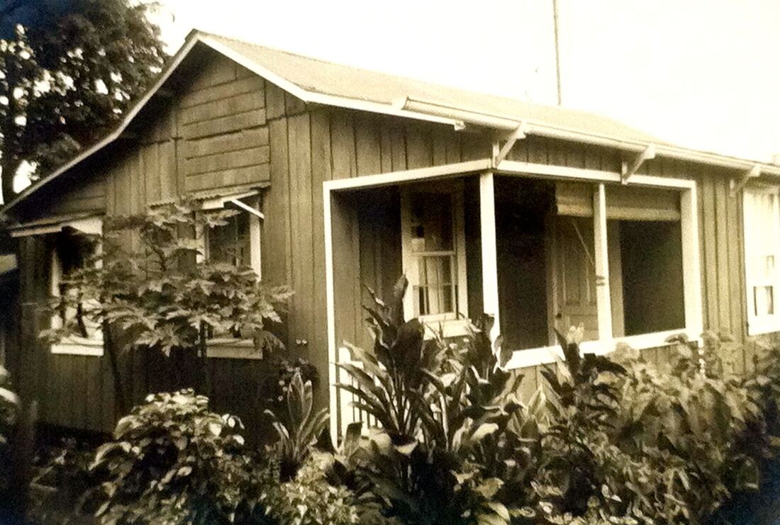
At the top of the slope was the big house, the home of the manager; below were the "nicer-looking" homes of the Portuguese, Spanish, and Japanese lunas, then the "identical wooden frame houses of Japanese Camp"; and finally the "more run-down Filipino Camp." Moreover, the organization of the housing hierarchy was "planned and built around its sewage system".  (Takaki, page 89, with additional quotes from Milton Murayama's work, All I Asking For is My Body)
Housing improved with the adoption of standard worker house designs developed by the Hawaii Sugar Planters’ Association (HSPA) and distributed industry-wide:
Between 1920 and 1925, millions were spent on repair, remodeling and construction of new housing. Single-family units had at least two bedrooms, with a wash house, baths, and privies nearby. However, only rarely was there running water or sewers, and streets were not paved or lighted. Yet, it was widely acknowledged that such amenities were needed and that the camps must be further improved. By 1925 the industry was pleased with the progress, mildly boasted of it, and labor was appeased, if not content...Another cycle of camp improvements started in 1930. Running water, sewers, attached baths, and larger houses became standard. (Dorrance and Morgan, pp. 130-131)
Picture
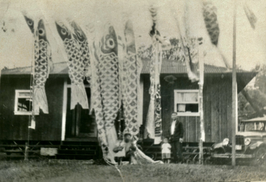
The Big House, i.e., Plantation Manager's house, located in Hakalau Upper Camp and built in 1897. Photo courtesy of the Lyman Museum
Picture
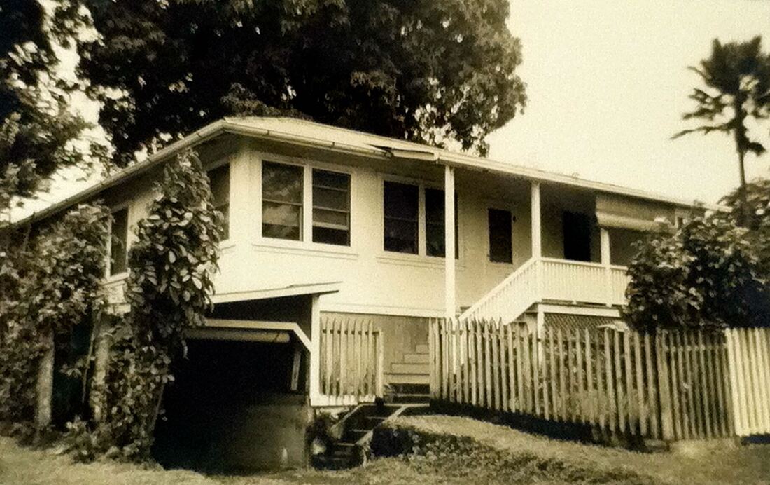
Hakalau Upper Camp House #105, one of the "nicer-looking" homes, built in 1903. Photo courtesy of the Hawaii Sugar Planters Association Archives at the University of Hawaii-Manoa - Hawaiian Collection within the Hilo Coast Processing Co. series.
Picture
Hakalau Upper Camp House #151, built 1914. Photo courtesy of the Hawaii Sugar Planters Association Archives at the University of Hawaii-Manoa - Hawaiian Collection within the Hilo Coast Processing Co. series.
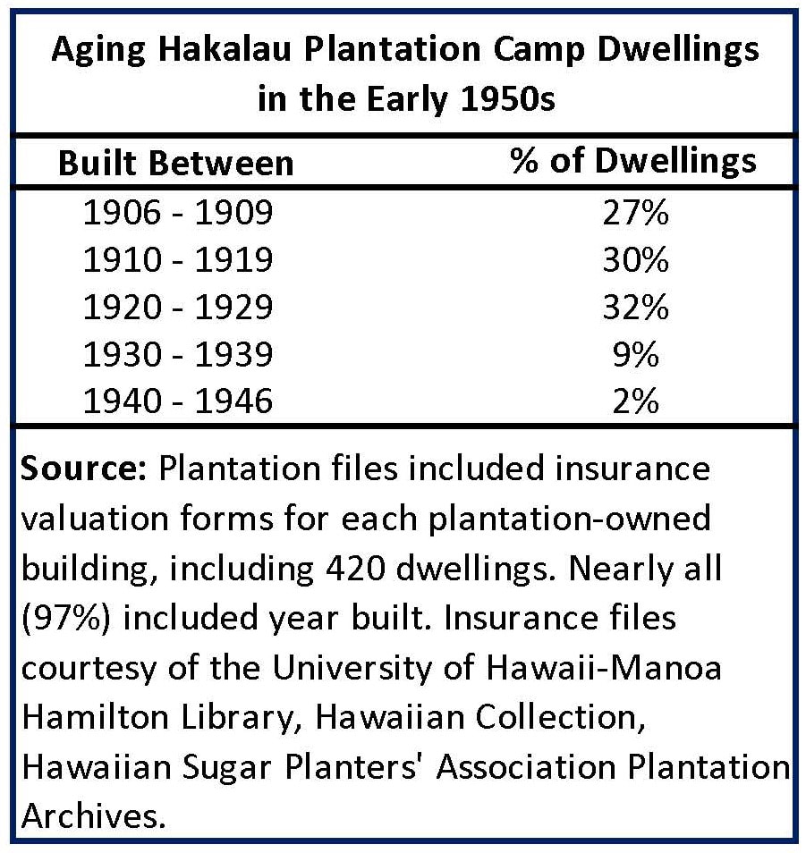
Age of Camp Dwellings
​

A great majority of the Hakalau Plantation houses were built between 1906-1929. By the later 1920s, as the result of mechanization, the entire workforce started to decline.  Industrywide, the workforce decreased by two-thirds from a total of 48,473 workers in 1925 to 15,935 in 1950. By the 1930s,  the plantation did not have enough incentive and/or funds to build more homes and its ability to maintain homes became more difficult.

​Three global events or circumstances greatly hampered the ability of the Plantation to invest in housing: the Depression in the 1930s, World War II in the 1940s, and thereafter, competition from other sugar markets worldwide with lower labor costs.  
Picture
Plantation Management Perspective Regarding Housing
​

A 1944 article in the Voice of Hakalau was republished in the newspaper describing the perquisite of free housing.
Picture
Picture
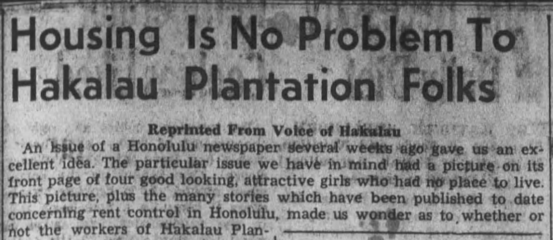
Hawaii Tribune Herald, April 13, 1944, accessed via Newspapers.com
Picture

Depopulation and Dismantling of the Camps:
​Timeline for the End of an Era

The long-term workforce reduction led to the depopulation of the camps.  The insurance photos of dwellings from the early 1950s sometimes identified vacant dwellings. In addition, the Occupant Lists from the early 1960s often did not have family names documented for individual dwellings.  These homes were probably vacant. Detail on the depopulation and subsequent dismantling of the camps is provided in the timeline below.
1925-1950: Industrywide, the workforce decreased by two-thirds from a total of 48,473 workers in 1925 to 15,935 in 1950.

​Prior to 1947: Vacated camps included Tara House Camp, Puerto Rican Camp, Uma Uma Mauka Camp, and Gulch Camp. These are shown on the 1944 Domestic Water Supply Map, but no maps for these camps were prepared by the plantation in 1947. Source: Domestic Water Supply Map

1950-1959: The viability of the Hakalau Plantation was repeatedly raised in the company's annual reports, along with mention of very limited maintenance to existing camp structures. For details, see 1950s Details of the Timeline.
 
1951: The construction of the new Territorial Highway through the plantation necessitated the relocation of ten houses at Hakalau upper camp, eight houses at Honohina, and five houses at Ninole. Source: 1951 Annual Report
 
1955:  The residents of Kamaee Korean and Ah Ling Camps were moved into more centrally located areas. Source: 1951 Annual Report

1956: All houses in three vacated villages, as well as the former Hakalau hospital building were sold to employees on a removal basis (this is the first reference to selling houses on a removal basis). Two unoccupied bachelors’ quarters in Hakalau upper village were remodeled and converted into offices for the industrial relations and industrial engineering departments. Source: 1956 Annual Report

1957: Several vacated houses in outlying villages were sold to employees for removal from the premises. Source: 1957 Annual Report

1958: The availability of vacant houses in centrally situated villages made possible the relocation of employees residing in outlying areas. Source: 1958 Annual Report

1961: Yokogawa Camp, located at Honohina Mauka, was vacated and all houses sold to be removed to buyers’ properties. Source: 1961 Annual Report

1962: Most of the 600 acres of Kamaee Mauka land, formerly cane land, to be planted in timber as a long-term investment. Source: Hawaii Tribune Herald, Hakalau Sugar Sets Up 600 Acres for Timber, January 21, 1962, accessed via Newspapers.com.

Fujimori Camp, an adjunct of Chin Chuck Stable Camp, and a portion of Wailea Spanish Camp were vacated and all houses and buildings sold on a removal basis. The vacated areas in both camps were cleared and planted in cane. Source:  1962 Annual Report
​
1963: Hakalau Plantation became part of the Pepeekeo Sugar Company. Manager Herbert Gomez gives a public talk on May 17, 1963 regarding consolidation of the population.  Source: Hawaii Tribune Herald, Kalanianaole, Hakalau Schools May Consolidate, May 14, 1963, accessed via Newspapers.com.

1964: A total of 27 company-owned houses and buildings were sold during the year on a removal basis. Residents of Spanish Camp were moved into Wailea Village. Source: 1964 Annual Report

1965: All vacant houses in Chin Chuck Stable Camp were sold on a removal basis. The Chin Chuck land would soon be plowed and planted in sugar cane. Source: 1965 Annual Report

1966: Groundbreaking took place for the new Kulaimano Subdivision developed by Pepeekeo Sugar Company, in conjunction with the ILWU. This was the first step in creating housing for sugar workers who were gradually being moved out of the old plantation camps along the Hamakua Coast. Source: Hawaii Tribune Herald, Groundbreaking Slated at Pepeekeo Subdivision, August 26, 1966 and New Housing Will Replace Old Plantation Camps, July 15, 1975, accessed via Newspapers.com.

1969: Honohina Hongwanji dismantled and sold on a removal basis in August 1969. Source: A Grateful Past A Promising Future, Honpa Hongwanji Mission of Hawaii, 1989

1970: Honohina houses demolished. Source: Hawaii Tribune Herald, 18 Ninole Families Wait to be Told Where They Can Live, January 3, 1971, accessed via Newspapers.com.

1971:  Plantation officials state:
  • "Let's face it, we're in the sugar business, not the housing business." 
  • “The plantation wants to get out of the housing business and its master plan calls for moving all employees to Kulaimano subdivision by 1975 if possible” 
​Source: Hawaii Tribune Herald, 18 Ninole Families Wait to be Told Where They Can Live, January 3, 1971, accessed via Newspapers.com.

1974: Hakalau Plantation Office and Hakalau Store demolished. Source: Hawaii Tribune Herald, ​Portrait of a Dying Town, April 9, 1975, accessed via Newspapers.com.

Funding approved for rental apartments in Kulaimano for persons of low and moderate income, primarily employees of Mauna Kea Sugar Company who were going to be displaced from plantation camps. Source: Hawaii Tribune Herald, Pepeekeo Housing Funding Approved, July 5, 1974, accessed via Newspapers.com.


1975: The demise of Hakalau Village (both Hakalau Upper Camp and Lower Camp) is described in Portrait of a Dying Town. Source: Hawaii Tribune Herald, Portrait of a Dying Town, April 9, 1975, accessed via Newspapers.com.

1977: Dwellings in Hakalau Lower Camp were gone by 1977. Source: Hawaii Tribune Herald, How Hakalau Changed from Farms to Homes, January 18, 2004, accessed via Newspapers.com.
 
By the 1980s, the camps of the former Hakalau Plantation were gone, with homes either moved elsewhere or demolished.
 
1982-1985: Hakushi Tamura, Minister at the Hakalau Jodo Mission from 1979-1996, shared his memories of what had been Hakalau Upper Camp during the period of about 1982-1985, a period when most of the houses were vacant or had been moved or demolished. Cane was planted wherever possible and the jungle was encroaching on the Mission. Source: email from Rev. Tamura.

1994: The last harvest of cane on the lands of the former Hakalau Plantation (later part of Pepeekeo Sugar, then Mauna Kea Agribusiness, then Hilo Coast Processing Company) took place in 1994.   By that time, most of the former Hakalau camp residents were living in Pepeekeo, either as renters or home owners. Source: Hawaii Tribune Herald, September 2, 1994, accessed via Newspapers.com.

How did we piece together this history?

Our understanding of plantation camps and life on the plantation comes from a variety of sources:
  • Personal Accounts from participants of Hakalau School and Community Reunions, other former camp residents and their descendants
  • C. Brewer Records for the Hakalau Plantation, including the Domestic Water Map (1944), hand-drawn camp maps (1947), Field Map (1954), annual reports from 1911-1965, provided courtesy of the Edmund Olson Trust Archive
  • Hakalau Plantation house photos provided courtesy of the Hawaii Sugar Planters Association Archives at the University of Hawaii-Manoa - Hawaiian Collection within the Hilo Coast Processing Co. series.
  • Photos from the John M. Ross Collection, courtesy of the Lyman Museum
  • Photos from the Waichi Ouye Collection, courtesy of his family
  • The Voice of Hakalau, the Hakalau Plantation newspaper published between 1940 and 1962, from the Waichi Ouye Collection, courtesy of his family.
  • Newspaper accounts from the Hawaii Tribune Herald and the Honolulu Star Bulletin, accessed via Newspapers.com
  • Books (Sugar Islands: The 165-Year Story of Sugar in Hawai`i by William H. Dorrance and Francis S. Morgan, Sugar Town by Yasushi “Scotch” Kurisu, and The Hamakua Coast by Ken Okimoto, Pau Hana: Plantation Life and Labor in Hawaii by Ronald Takaki)
For the Hakalau Kuleana, our responsibility is to care for the land, the people, and the culture. We are guided by cultural values of YESTERDAY: Engage in collective effort. Look out for each other. Honor hard work. Show respect for those who came before us. Aloha and Mālama `Aina. In 2021, Akiko Masuda added two more values to the list: Consistently show up. Whatever has to be done, jump in and do it!