The Camp Map
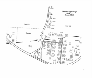
Click map to enlarge |
The Houses
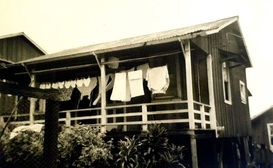
Click photo to view all camp houses
Community and Sugar Production Buildings
(Upper and Lower Honohina Camps) 
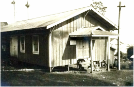
Click photo to view all community and sugar production buildings
|
Occupant Names
|
Honohina Upper Camp
Location: Located about 3 miles up the coast from the Hakalau Camps and the mill, it was directly mauka of Mamalahoa Hwy.
Camp size: About 35 dwellings, a store, a pool hall, and a garage.
Time period: The map dates to 1947. House photos date to the early '50s and Occupant list dates to the early ‘60s.