Kamaee Camps
All 3 Kamaee Camps are included below. They were vacant by the early 1960s.
|
The Camp Maps
Created 1947 |
The Houses
Photos Taken Early 1950s |
Kamaee Mauka
Location: Drive mauka on Chin Chuck Road. Turn right off Chin Chuck Road onto Kamaee Road (no longer accessible), directly above Chin Chuck Stable Camp, for a distance of about a mile. About 1200 feet elevation.
Camp size: About 5 plantation-owned dwellings and another 10 privately owned dwellings. Mauka Camp also included a Scout camp that served all Hakalau kids, and a community clubhouse. All of plantation-owned dwellings were vacant by the early 1960s.
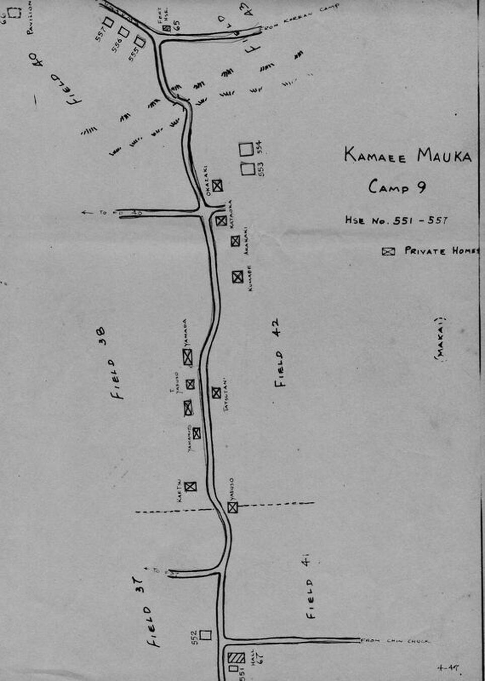
Kamaee Mauka Camp (click map to enlarge)
|
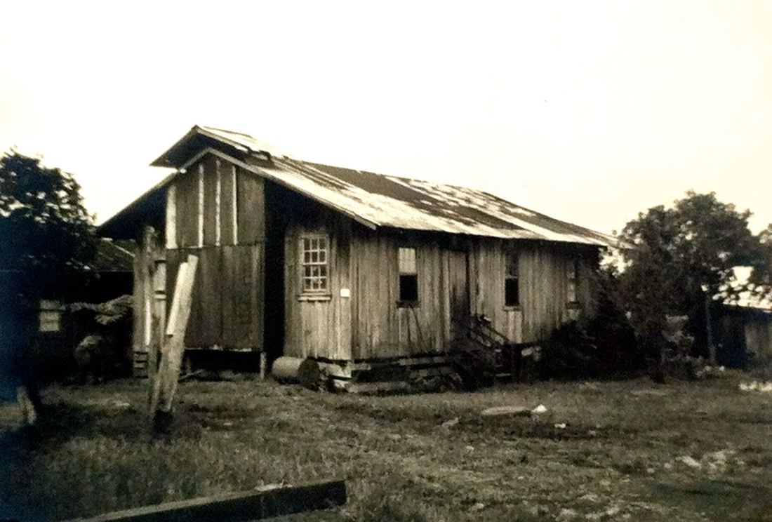
Kamaee Mauka Camp (click photo to see all houses)
|
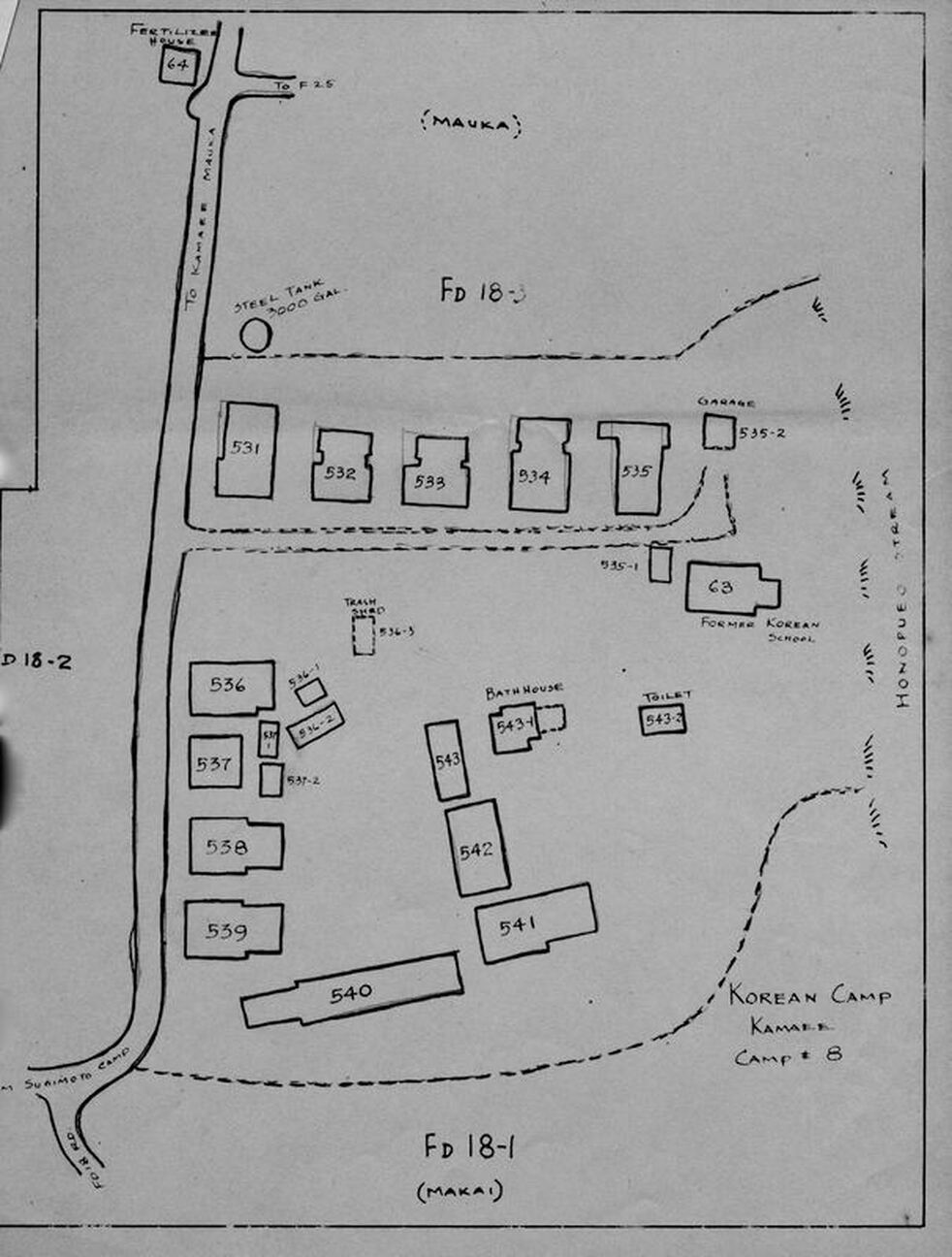
Kamaee Korean Camp
Location: In a makai direction from Kamaee Mauka Camp about 2 miles, it was at about 300 feet elevation and near Kamaee Sugimoto Camp. It could also be accessed from a road off Mamalahoa Hwy just past Hakalau Gulch going up the coast.
Camp size: It included about 10 dwellings, all vacant by the early 1960s.
|
Kamaee Korean Camp
(click photo to see all houses) |
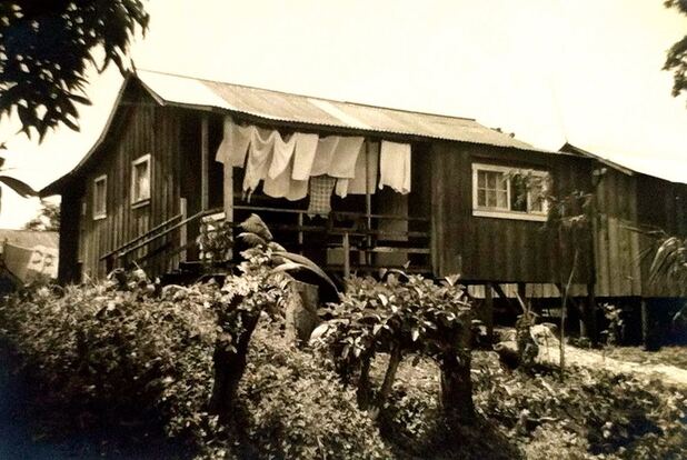
Kamaee Sugimoto Camp
Location: In a makai direction from Kamaee Mauka Camp about 2 miles, it was at about 300 feet elevation and near Kamaee Korean Camp. It could also be accessed from a road off Mamalahoa Hwy just past Hakalau Gulch going up the coast.
Camp size: It included about 20 dwellings, all vacant by the early 1960s.
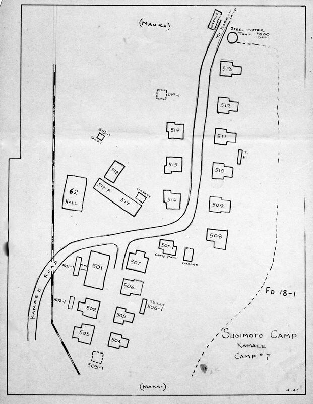
Kamaee Sugimoto Camp
(click map to enlarge) |
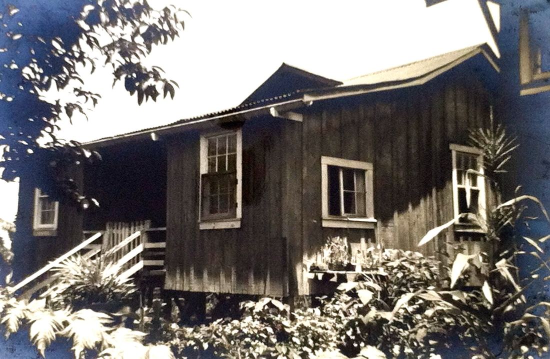
Kamaee Sugimoto Camp
(click photo to see all houses) |