Bridges
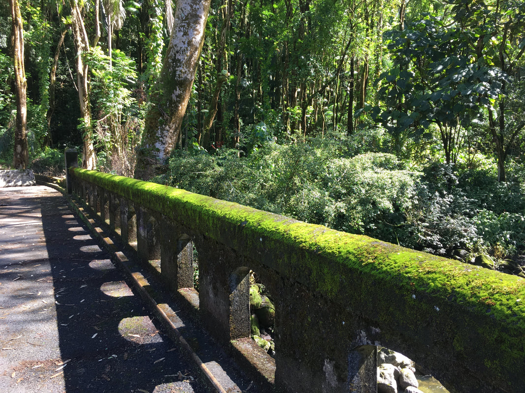
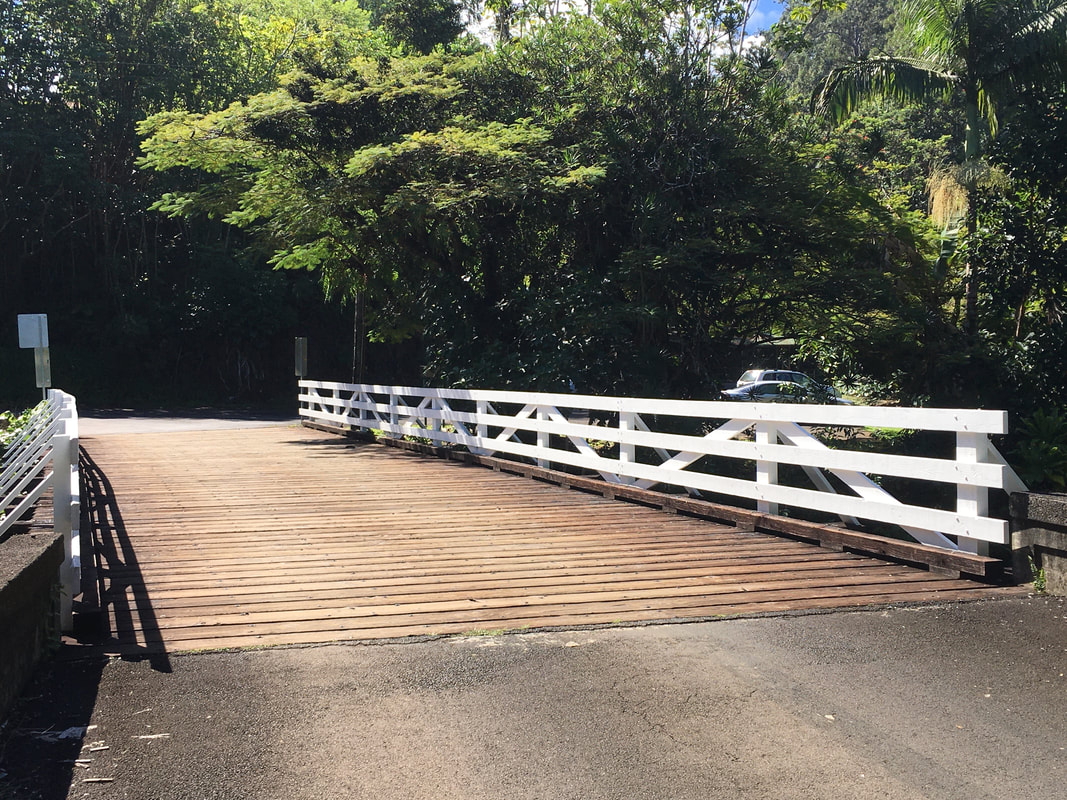
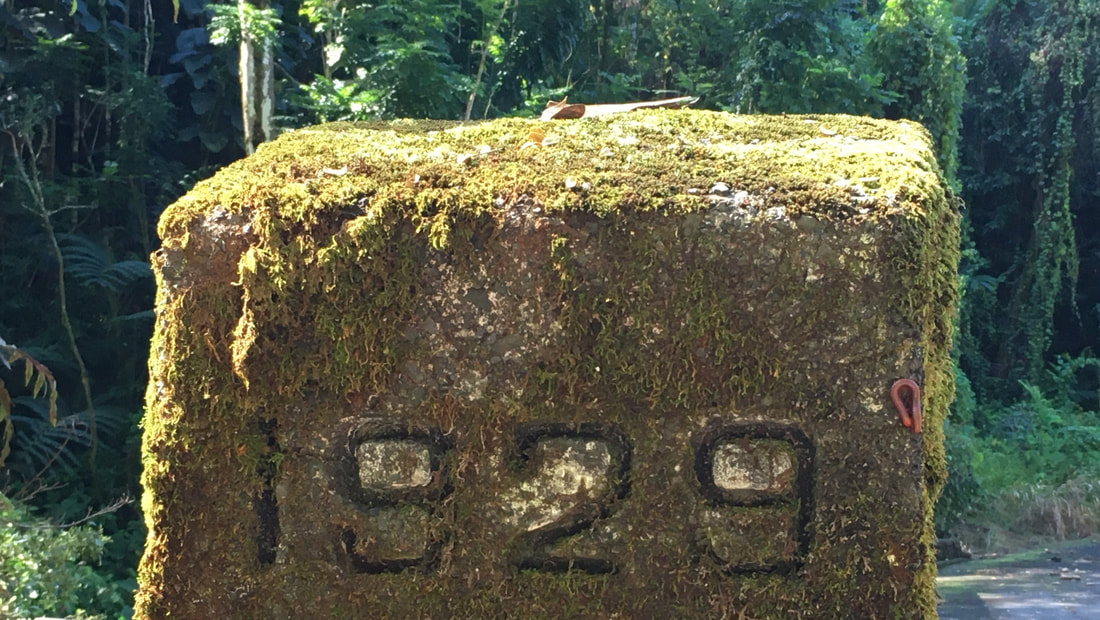
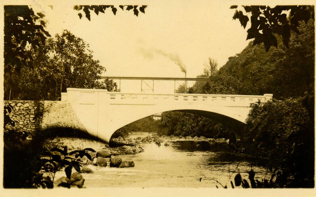
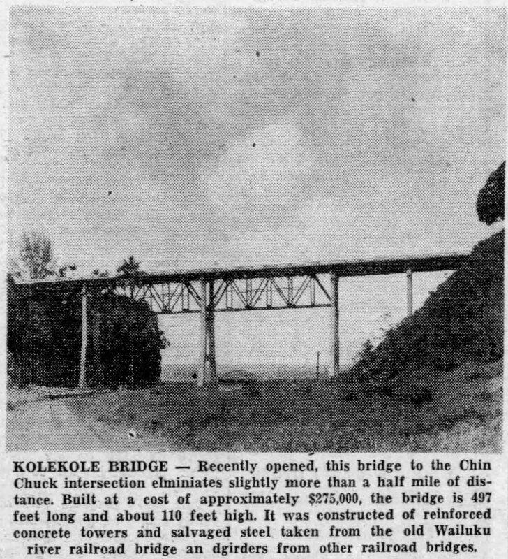
Kolekole Stream Bridge today, built 1929
Traditionally, Hakalau is in an area once called Hilo-Palikū (Hilo of the upright cliffs), an area that extended from the bank of the Wailuku river to the Ka'ula gulch, which served as the division between Hilo and Hamakua. Because of the numerous streams, valleys and gulches, several sayings were used to describe the region, which at times, was treacherous to travel through. One saying describes the region:
0 Hilo-Palikū kahi i 'olelo 'ia ai-Pau ke aha I ka hele o Hilo, he !au ka pu'u, he mano ka ihona, he kini na kahawai, a e 'au no ho'i ka wai o Hilo a pau ke aha, a'ohe e pau ka waif
Of Hilo-Palikū it is said - One becomes short of breath traveling through Hilo, for there are many [400] hills, many [4,000] areas to descend, and many [40,000] streams to cross; indeed, while swimming through the waters of Hilo one becomes out of breath, but one is never out of water at Hilo.
...Then we reached the lofty top of the great Hakalau gulch, the largest of all, with the double river, and the ocean close to the ford. Mingling with the deep reverberations of the surf, I heard the sharp, crisp rush of a river, and of "a river that has no bridge".
|
|
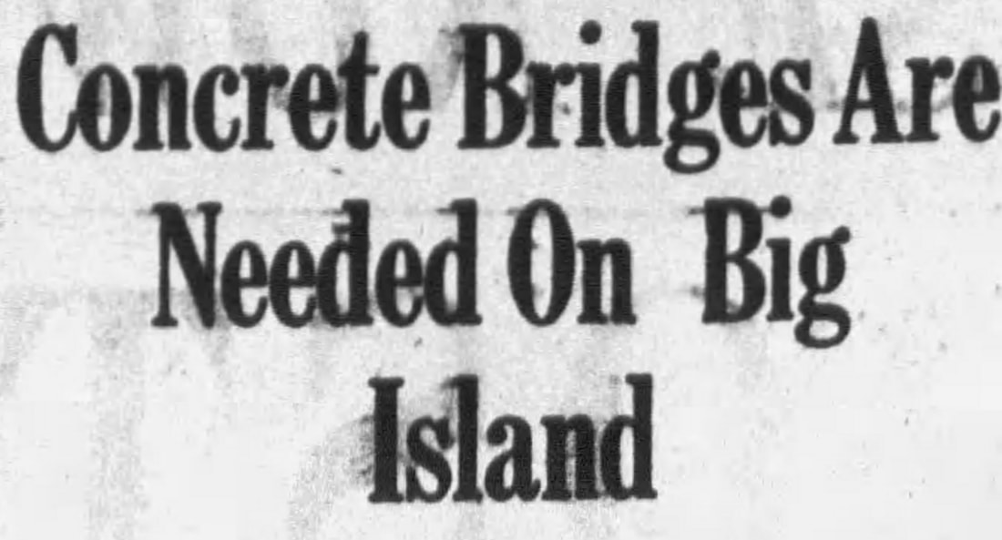
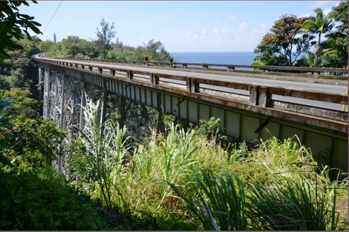
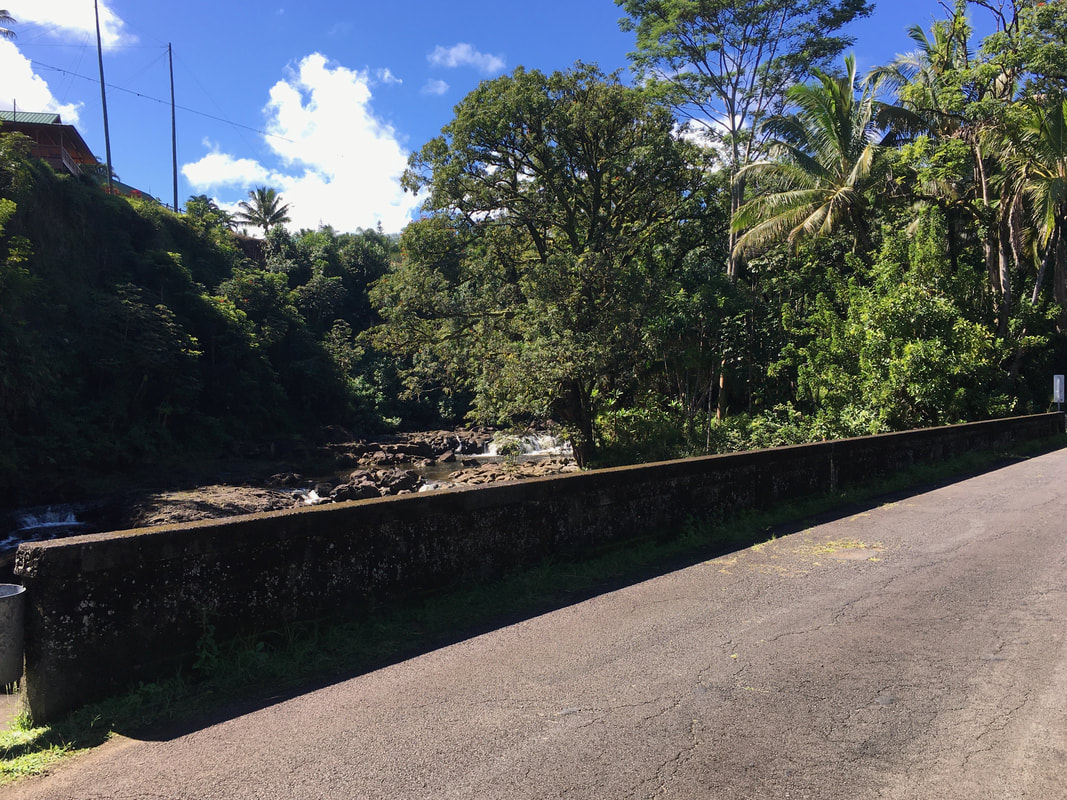
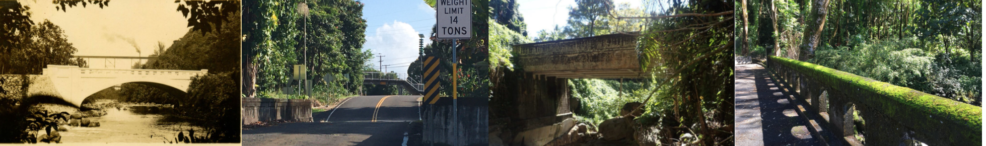
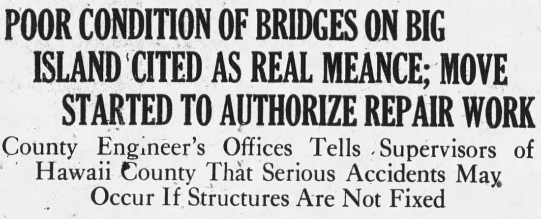
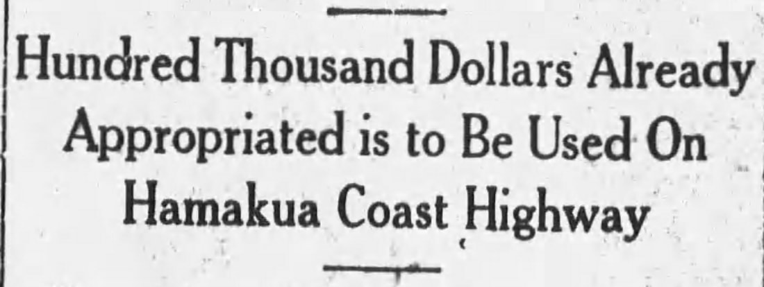
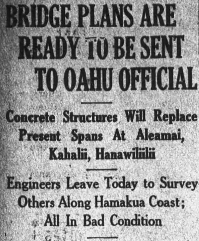
Hawaii Island contains by far the greatest concentration of historic bridges, perhaps due to its rural nature and consequent lack of development, and an abundance of land for alternate transportation routes without the destruction of older bridges and roads. Most of the Big Island's bridges are located along the Hamakua Coast, north of Hilo, due to its abundant rainfall and innumerable streams and gulches. In the 42.5 mile stretch from Hilo to Honokaa on FAP (Federal Aid Primary Route) 19, there are fifty‐one bridges, more than one bridge per mile. Remnants of the Mamalahoa Highway, the former belt road which runs parallel to the new highway, serve as a sort of "bridge museum" with examples of almost every remaining bridge type in the islands, including some of the oldest and rarest bridges found in the islands. A number of early masonry (lava‐rock) arch bridges dating from 1894‐1903 are located along the Mamalahoa Highway and are the oldest remaining bridges in the state.
|
Bridge reports are available on the National Bridge Inventory. Click on the link for each of our bridges listed below:
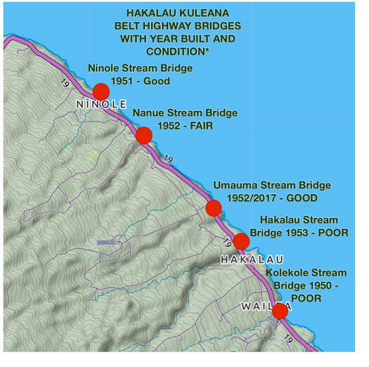
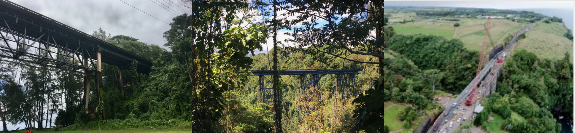
Belt Highway Bridges
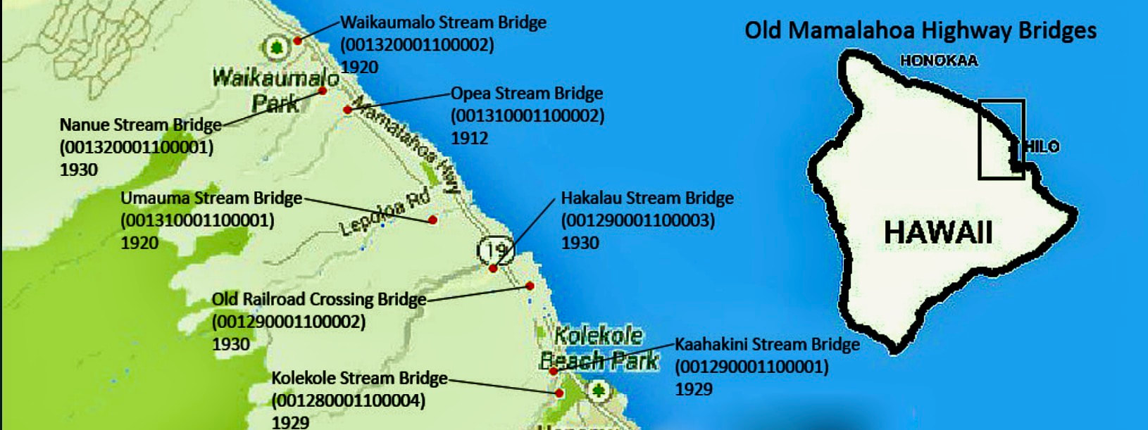
Old Mamalahoa Bridges
|
|
|
Waikamalo Stream Bridge today, built 1930
|

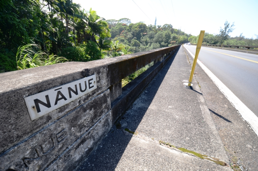
Nanue Stream Bridge today, built 1930
|
Opea Stream Bridge today, built 1912
|
Umauma Stream Bridge today, built 1920
|
|
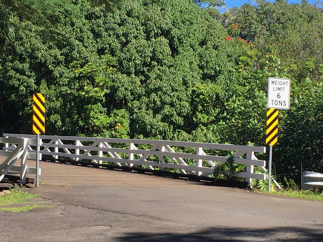
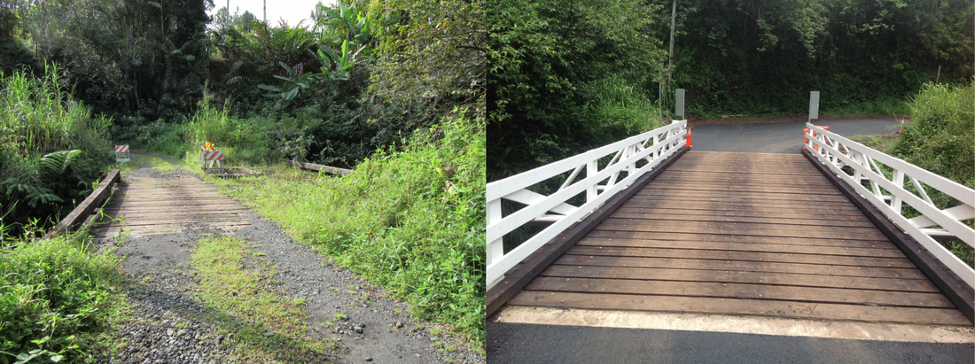
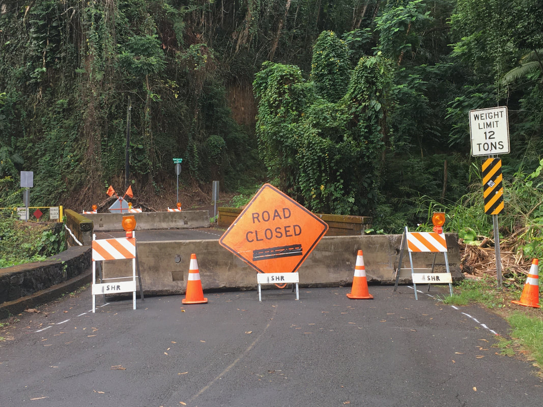
Bridges might not appear on official lists if they are located on private property or on Roads in Limbo. One such road is Kanna Road, known also as Broken Bridge Road and Chicken Farm Road. It extends from Chin Chuck Road to Kaiwiki Homestead Road. This is a wooden bridge and, as the alternative name "Broken Bridge' suggests, Broken Bridge Road, provides a clue that there might have been some problems with the bridge in the past.
Roads in Limbo (RIL) were built or, planned by the State or the Territorial government. They are classified into either existing or paper roads. For decades, the State and County government argued over maintenance responsibility because of limited resources. |
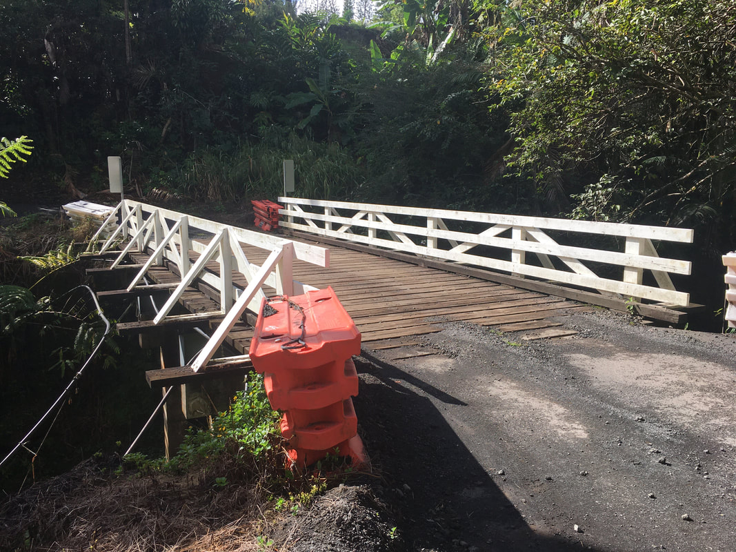
The Kanna Road bridge over the Ka`ahakini Stream is the only route available to residents of Kaiwiki Homestead (as of October 30, 2020). Photo courtesy of Susan Forbes
|
|
1896:
Hawaii Herald, November 12, 1896, accessed via Newspapers.com
1904:
The Hilo Tribune, April 29, 1904, accessed via Newspapers.com
1905:
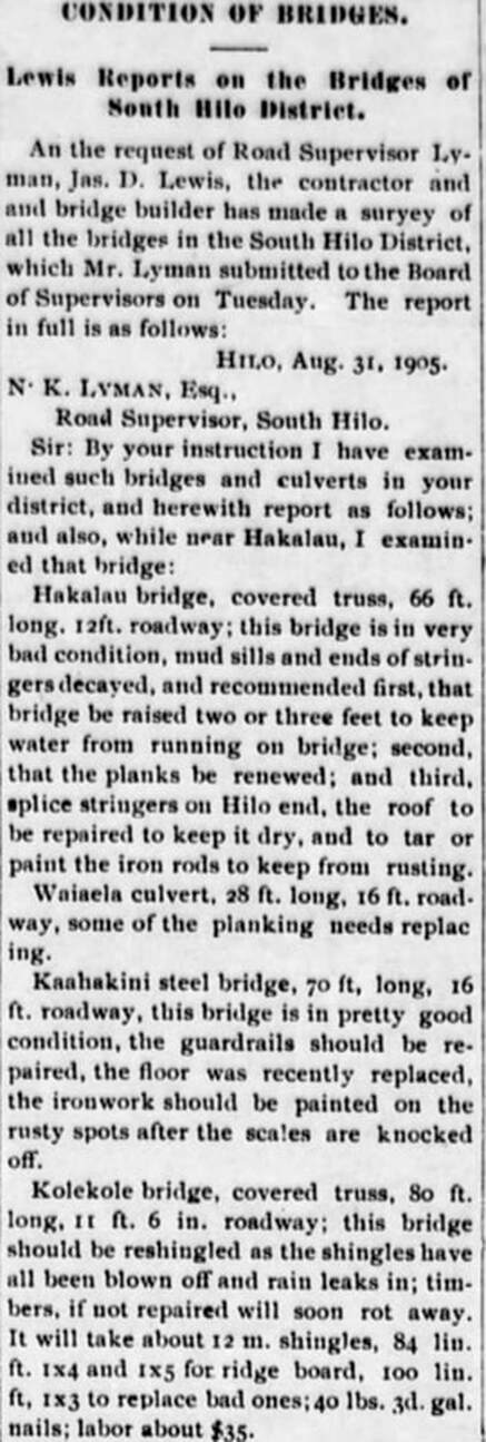
The Hilo Tribune, September 12, 1905, accessed via Newspapers.com
|
1907:
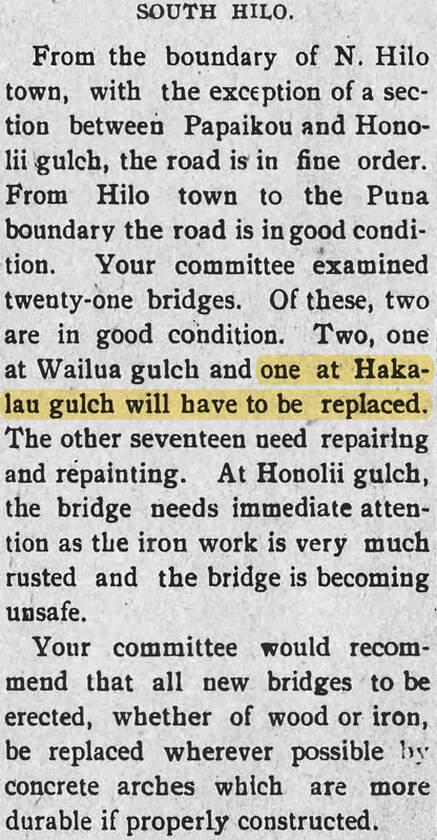
Hilo Daily Tribune, July 9, 1907, accessed via Newspapers.com
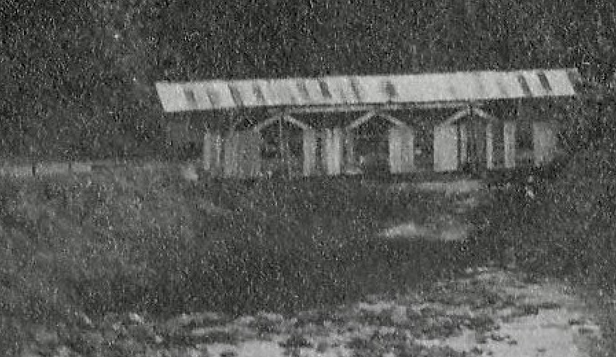
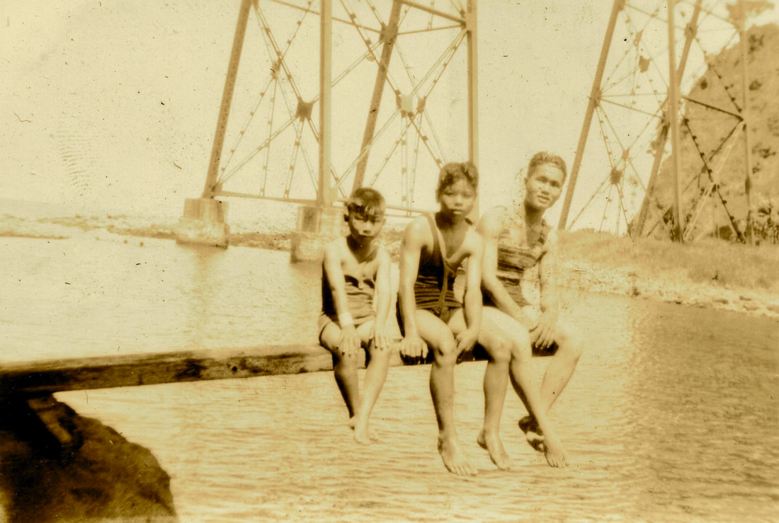
Example: Hakalau Gulch Camp and Its Covered Bridge

Hakalau Gulch Camp with a covered bridge in the background on the left, where the 1930s bridge is now. Photo taken sometime between 1911 and 1929. Photo courtesy of the Lyman Museum
The wooden covered bridge over Hakalau Stream, located of the left side/middle of the picture above and in the close-up below, was replaced circa 1907 and then again with a concrete bridge in 1930. It's unknown whether the picture depicts the original wooden bridge or the replacement bridge.
|
Hawaii Tribune Herald, March 11, 1930, accessed via Newspapers.com
|
Hawaii Tribune Herald, March 25, 1936, accessed via Newspapers.com
|
|
1918:
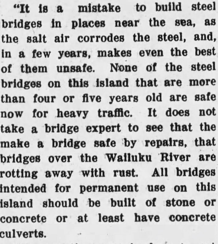
Hawaii Tribune Herald, February 11, 1918, accessed via Newspapers.com
|
1919:
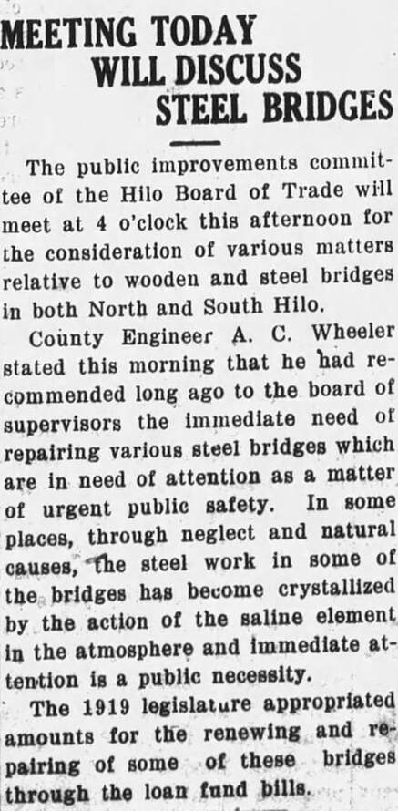
Hawaii Tribune Herald, July 31, 1919, accessed via Newspapers.com
|
 Hawaii Tribune Herald, August 12, 1940, accessed via Newspapers.com Hawaii Tribune Herald, August 12, 1940, accessed via Newspapers.com
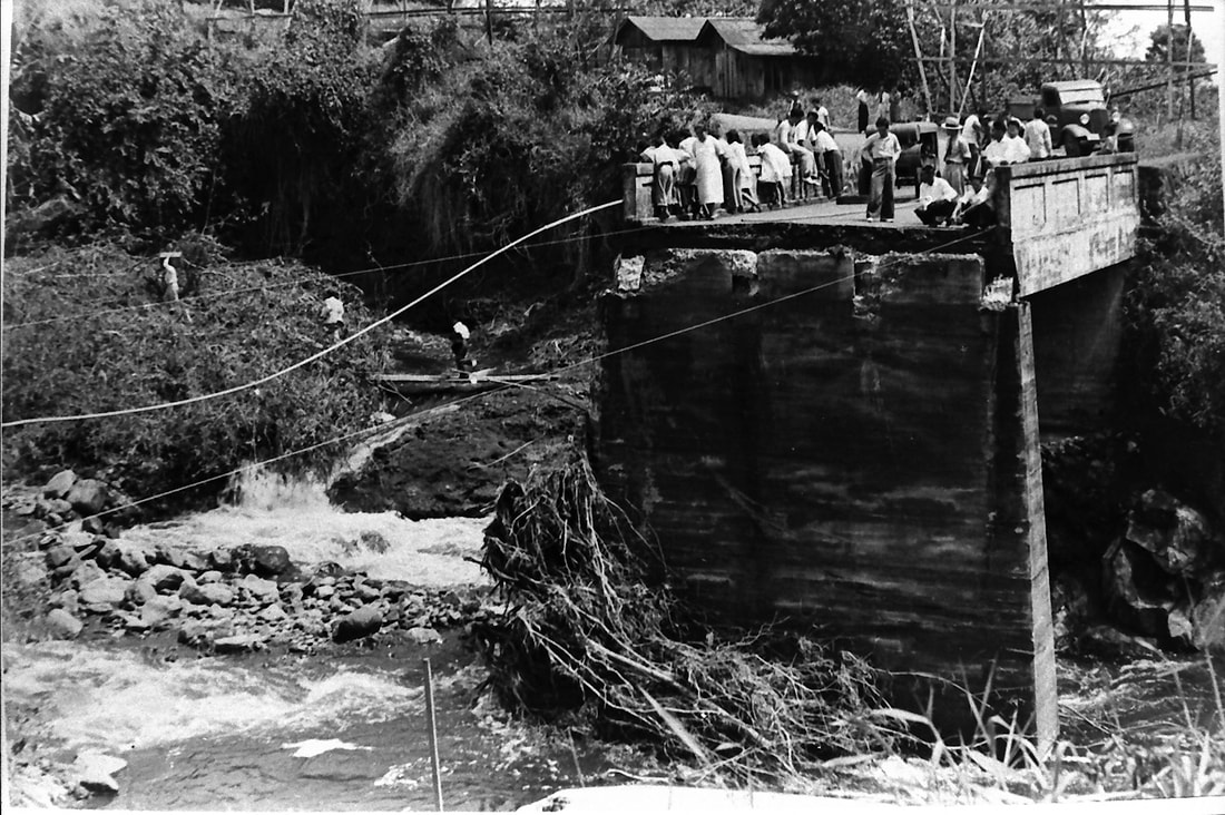
Waikaumalo Bridge washed out during heavy rains in March 3, 1939. Photo courtesy of the Lyman Museum.
Waikaumalo Stream Bridge in December 2020, photo courtesy of Susan Forbes
|
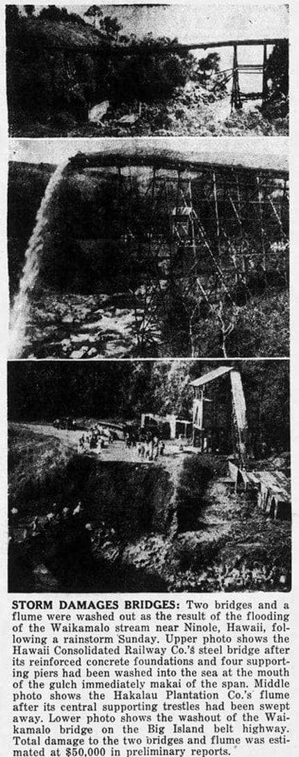
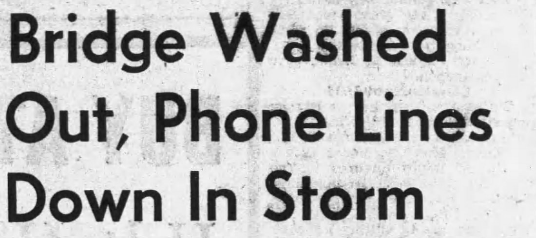
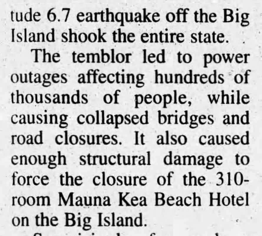
The storm was Sunday, August 11, 1940. Hawaii Tribune Herald, August 16, 1940, accessed via Newspapers.com
|
|
Before
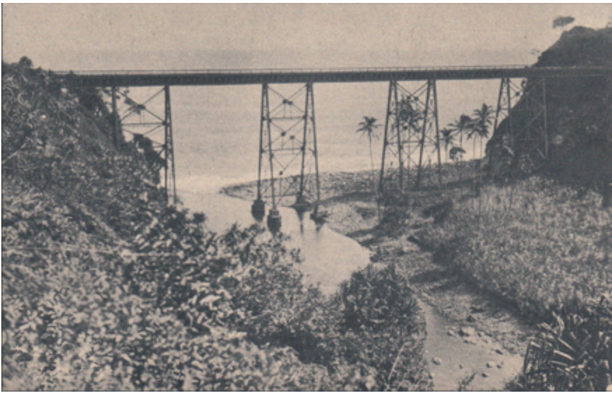
Kolekole Railroad Bridge taken prior to 1923.
After
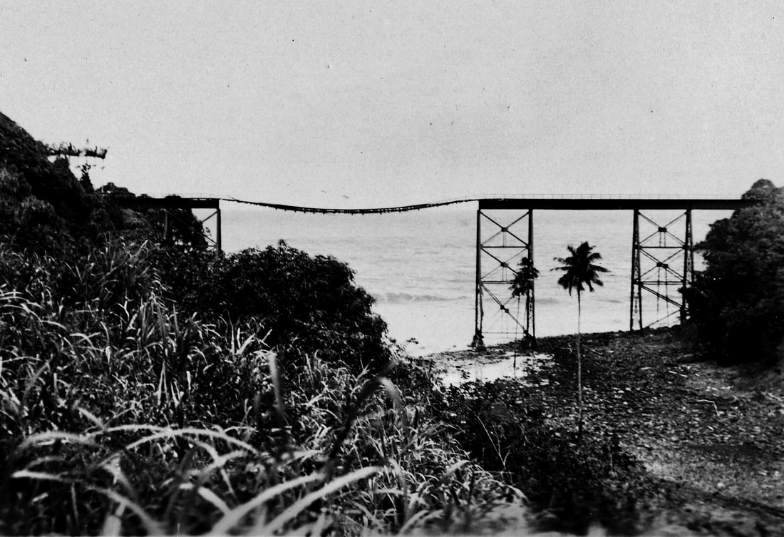
Kolekole Railroad Bridge after the April 1, 1946 tsunami. Photo from the Waichi Ouye Collection, courtesy of his family.
|
Yet Another View of After
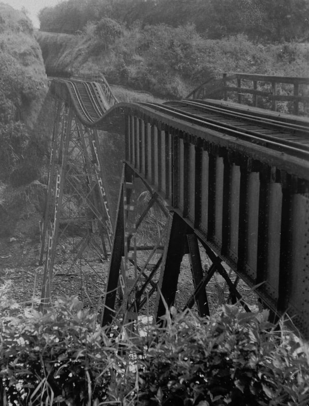
Photo from the Waichi Ouye Collection, courtesy of his family
|
|
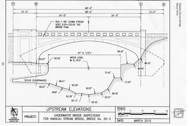
Underwater Bridge Inspection for Hakalau Stream Bridge, Prepared for the Hawaii County Department of Public Works, March 2016.
|
|
Ka`ahakini Stream Bridge, photo courtesy of Susan Forbes
|

|
Hawaii Tribune Herald, December 28, 2006, accessed via Newspapers.com
|

Hawaii Tribune Herald, June 22, 1928, accessed via Newspapers.com
Hawaii Tribune Herald, July 14, 1928, accessed via Newspapers.com
|
Hawaii Tribune Herald, November 21, 1928, accessed via Newspapers.com
Hawaii Tribune Herald, December 3, 1928, accessed via Newspapers.com
|
|
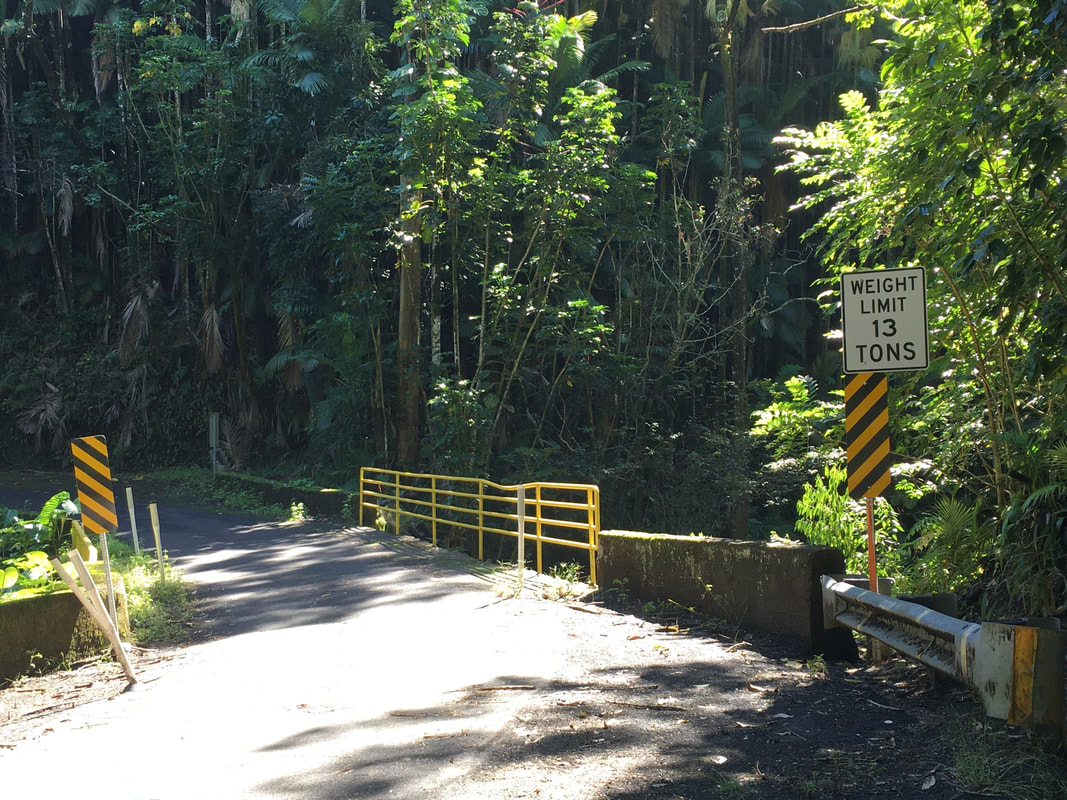
1929 - Kolekole and Ka`ahakini Stream Bridges on Old Mamalahoa Highway
Kolekole Stream Bridge
Kolekole Stream Bridge, built 1928. Photo taken December 1, 2020, courtesy of Susan Forbes
Ka`ahakini Stream Bridge
Ka`ahakini Stream Bridge, built 1929, photo taken November 8, 2020, courtesy of Susan Forbes.
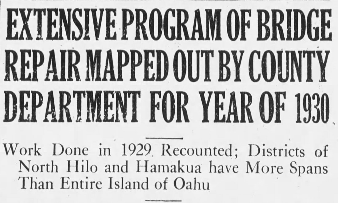
Hawaii Tribune Herald, September 29, 1930, accessed via Newspapers.com
|
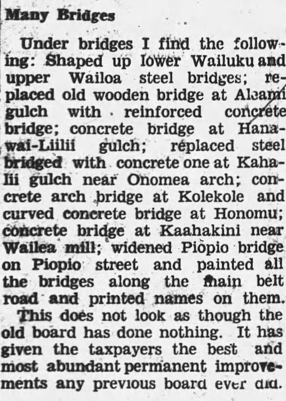
1930 - Nanue Stream Bridge and Hakalau Stream Bridge on Old Mamalahoa Highway
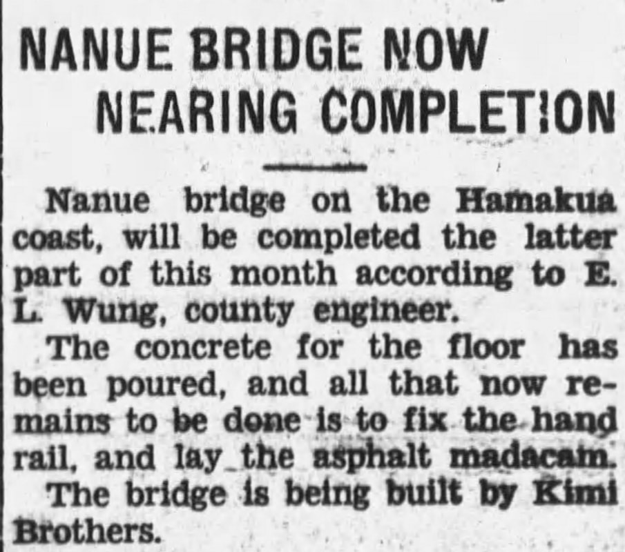
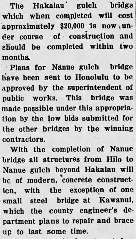
Hawaii Tribune Herald, May 6, 1930, accessed via Newspapers.com
Nanue Stream Bridge, built 1930, located on Old Mamalahoa Highway. Photos courtesy of Susan Forbes, taken December 1, 2020.
Hakalau Stream Bridge on Old Mamalahoa Highway
Hakalau Stream Bridge, 1930, from the Waichi Ouye Collection, courtesy of his family.
Hawaii Tribune Herald, December 28, 1929, accessed via Newspapers.com
|
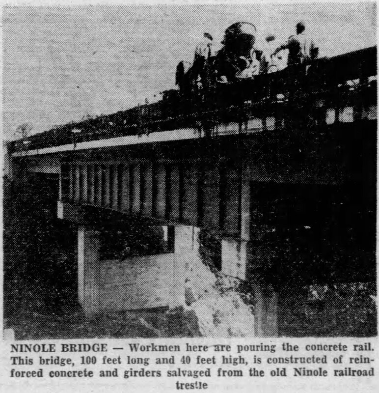
Hawaii Tribune Herald, June 10, 1951, accessed via Newspapers.com
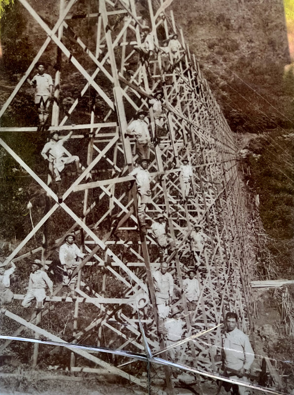
This photo, showing workers on the highway bridge, is on display at Hakalau Bay Park, source unknown.
|
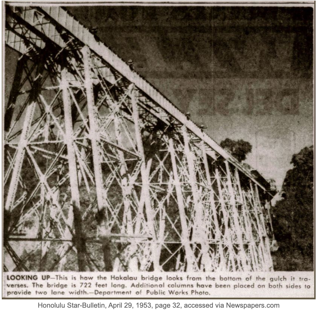
Hawaii Tribune Herald, June 10, 1951, accessed via Newspapers.com
|